


Arctic sea ice update: June 2025
Sea ice extent back into record low territory

After a bit of recovery in April and May, sea ice extent for the Arctic overall is back to being the lowest in the 47-year satellite record.
****Late breaking news****
Literally as I was about to hit "“send” on this post, EUMETSAT posted that the US DoD will cease distributing the underlying data used in the NSIDC and EUMETSAT sea ice analysis as of June 30. This had been expected at the end of September. We’ll find out soon but this very likely means a disruption to global sea ice products. The AMSR2 data aboard the Japanese Space Exploration Agency (JAXA) GCOM-W1 satellite remains an independent source of global sea ice data.

Arctic sea ice extent
Sea ice extent for the Arctic overall since summer 2025 solstice ranks as lowest for this point in the season in analysis from the three major global sea ice data providers: National Snow and Ice Data Center (NSIDC), JAXA and EUMETSAT.
Figure 1 showing the daily Arctic sea ice extent for the past two years plus the 1981-2020 median and 10-90 percent range. Sea ice extent has declined just over 30 percent since the seasonal maximum. This is well above the typical ice loss between maximum extent and June 23.
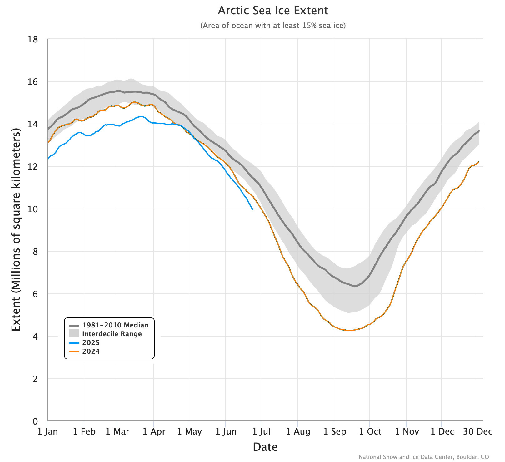
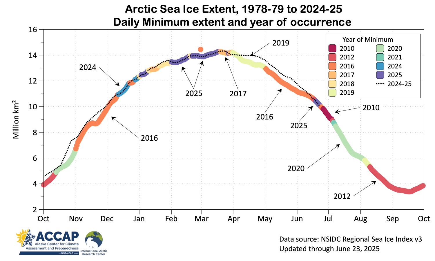
Figure 2 plots the lowest daily sea ice extent in the NSIDC data for each day of the year and is color coded to show the year of occurrence. Sea ice extent has been at the daily record low in 2025 on 57 days. Only 2012 and 2016 have more “record low” days.
Regional perspective
Figure 3 shows the regional seas sea ice extent rankings for June 23. The Canadian Archipelago westward to the Chukchi Sea still have lots of ice relative to the past 47 years. It’s really the Siberian and Atlantic regional seas that are driving the overall record low Arctic-wide extent.
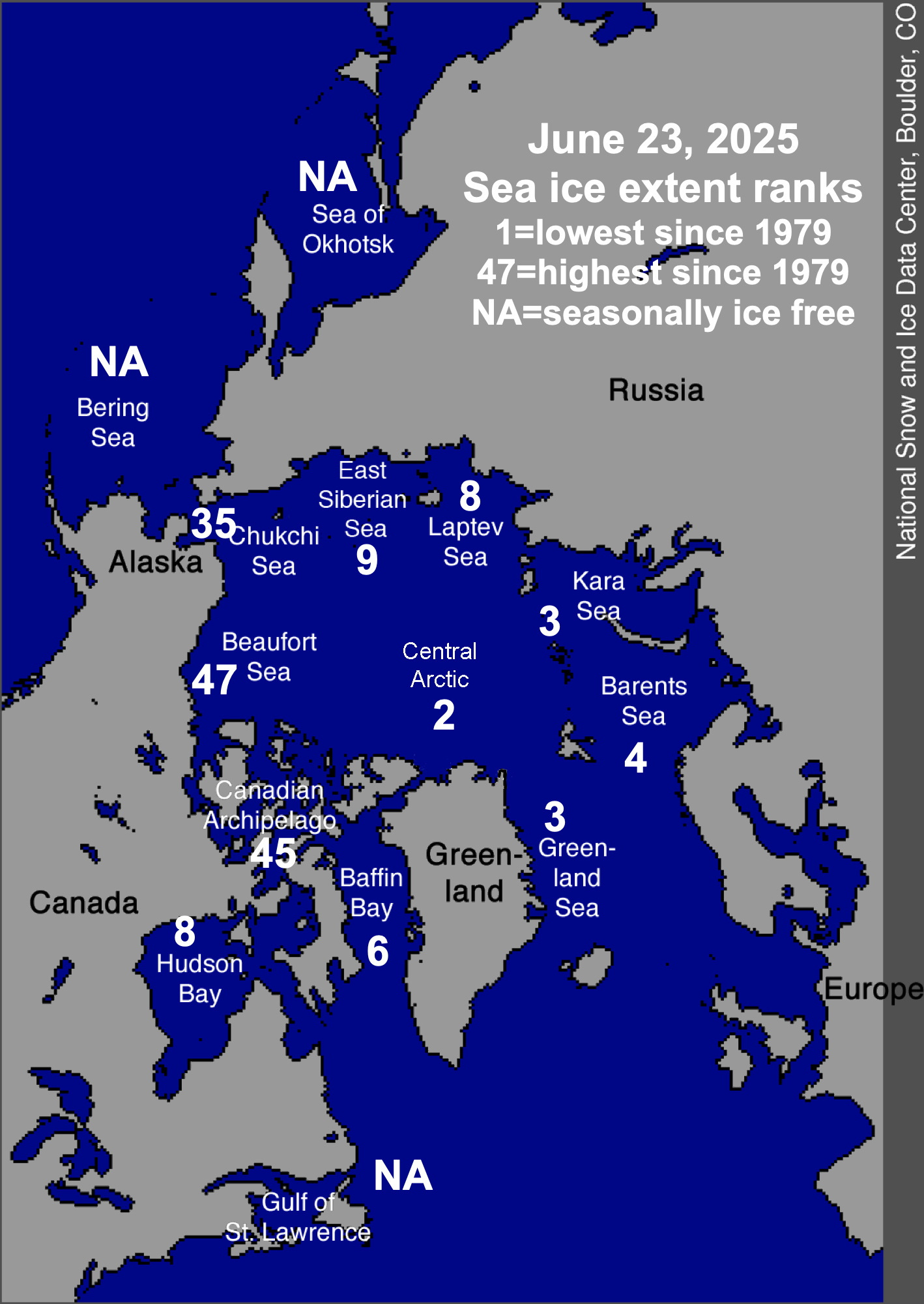
For some seas the rankings at this point in the season can still be somewhat misleading. For example, the Central Arctic basin currently ranks as second lowest, which is true, but only 3 percent of the basin has open water. In the Beaufort Sea, the NSIDC has no open water analyzed. However, that’s not especially unusual: eight other years since 1979 had no open water on June 23, most recently in 2022.
Has ANY reason been given as to WHY the DoD is cutting off this data distribution?
ALL Micro-Wave data (that 3 Hurricane models & forecasters utilize) are also going to be withheld from any distribution. (This is in addition to the arctic ice data)
https://open.substack.com/pub/michaelrlowry/p/critical-hurricane-forecast-tool?utm_campaign=post&utm_medium=web