

September 2024 Arctic Climate Summary
September 2024 Arctic Climate Summary
Warmest and second wettest September

For the second year in a row, warm and wet (comparatively speaking) is the headline for the Arctic in September.
Note: to keep posts to a reasonable size, the September 2024 climate review will be a two-parter. This is the Arctic edition. I’ll do a separate post with the Alaska summary.
Temperatures
September was warmer than normal over the vast majority of the Arctic: 95 percent of lands north of 60°N were warmer than the 1991-2020 baseline. For the Arctic overall, (land and seas north of 60°N), 85 percent of the region was warmer than normal and a whooping 25 percent of the Arctic had a top-three warmest September (since 1950). As highlighted in Fig. 1, Nunavut, Canada was especially mild. The average temperature for the territory was by far the highest for September on record, 1.6°C (2.9F) higher than the previous record set in 1998. Also, nearly all of the European Arctic was much warmer than normal. Only Iceland and the greater Bering Strait region were cooler than average.
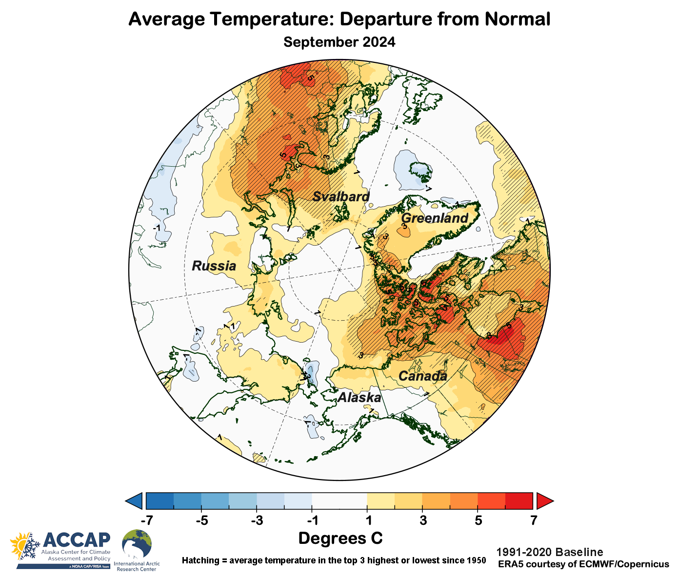
Unsurprising, this was the warmest September on record, slightly exceeding September 2023. Arctic lands also saw the warmest September, exceeding last year by a substantial 0.6°C (1.0°F); that might not sound like a lot until you consider this is over an area of 17,000,000 km² (6.5 million sq. miles).
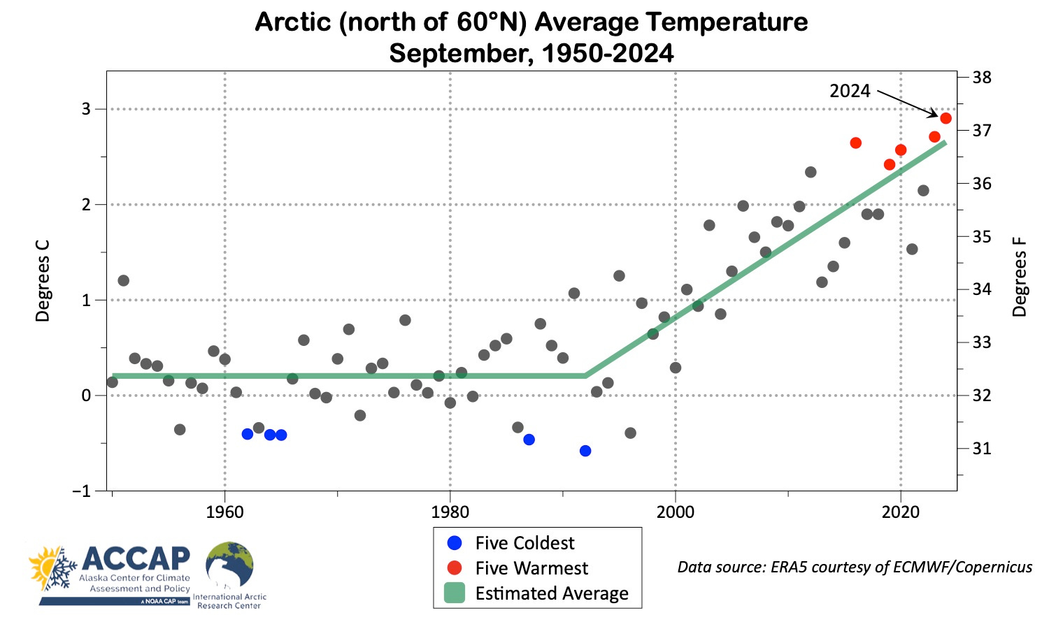
The trend in September average temperatures, shown in Fig. 2, has been dramatic since the 1990s. In just 30 years, the (statistically modeled) average temperature has increased by 2.5°C (4.4°F).
Precipitation
While precipitation is always spatially more variable than temperatures, overall this was a very wet September in the Arctic. Much of Arctic Canada saw well above normal precipitation and this coincided with areas that were also much warmer than normal. But in the eastern European Arctic, areas that were significantly warmer than normal during the month were much drier than normal.
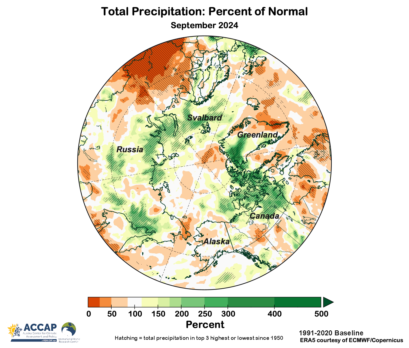
The areas with high precipitation (14 percent in the top-three wettest) were much larger than areas with unusually low precipitation (3 percent in the top-three driest). Putting it all together, this was the second wettest September for the Arctic (since 1950), with the average precipitation just slightly below the record set only last September.
Sea ice
The 2024 sea ice minimum in NSIDC data was reached on September 11 and was seventh lowest in the past 46 years. More details in my post here.
The National Snow and Ice Data Center on October 3 issued a useful summary of the 2024 summer Arctic sea ice season, link here. Here are a couple of the highlights.
Northwest Passage
This was a record low ice season for the Northwest Passage, with the northern route at the lowest ice extent on record as of October 1. This is the “deep water” passage, suitable for large vessels. The southern route nowadays opens in most years, and this year was no exception. Similar to 2023, this route was virtually ice-free for most of September.

Chukchi Sea Ice
The NSIDC recap also highlighted the area of ice that has persisted all summer in the western Chukchi Sea between Wrangel Island the far northeast Russian coast. Figure 5 is a false color image from September 21 showing the extent of the ice at that time. Since July some of this ice has been moving in the East Siberian coast current to the west side of the Bering Strait, and that can be seen in this image.
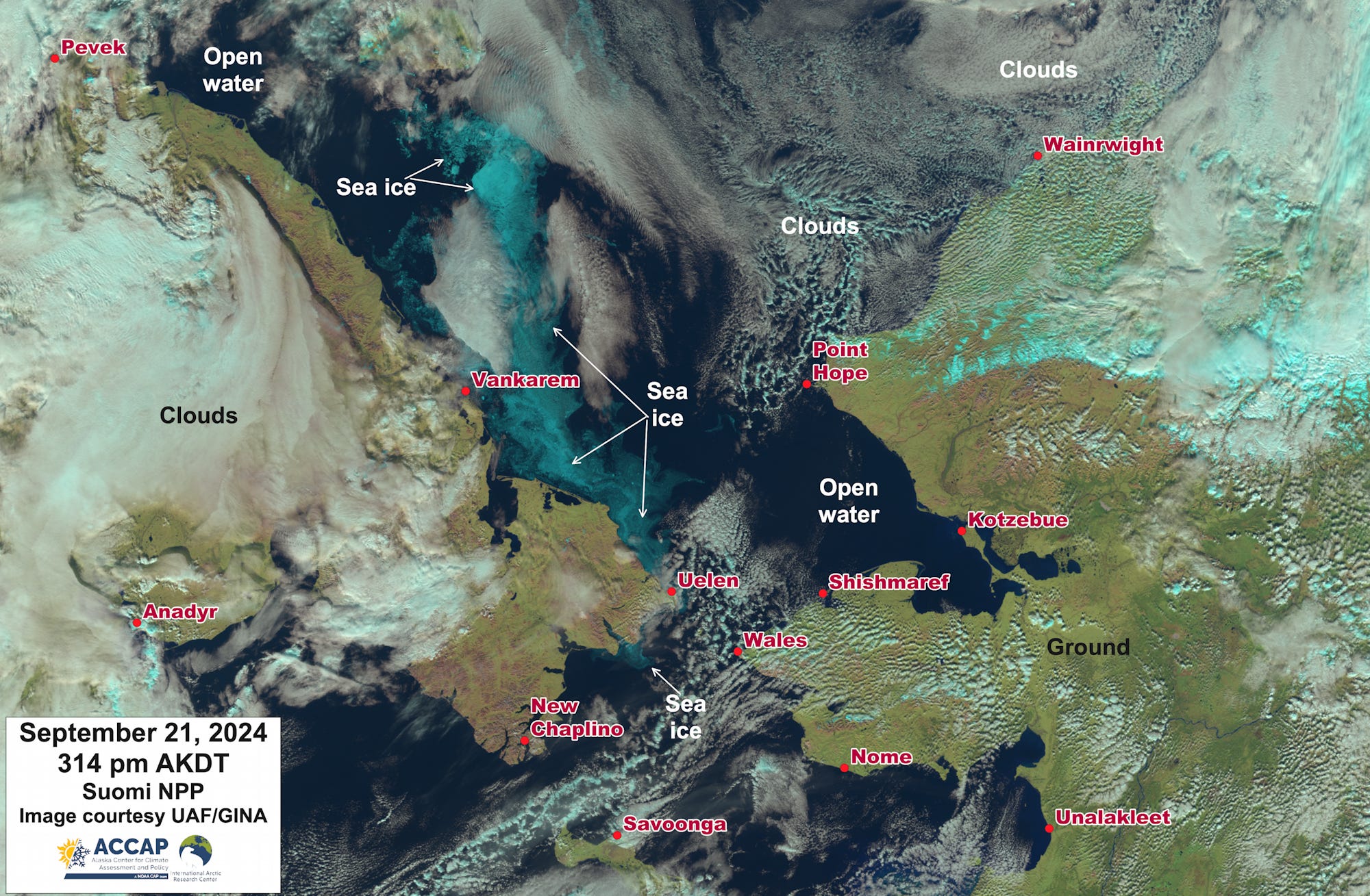
The last time there was ice to the Russian coast southeast of Wrangel Island in mid-September was back in 1998. Although this ice has continued to melt through the first days of October, most of it will survive to be second-year ice for the 2024-25 winter.