Record Winter Warmth at Utqiaġvik
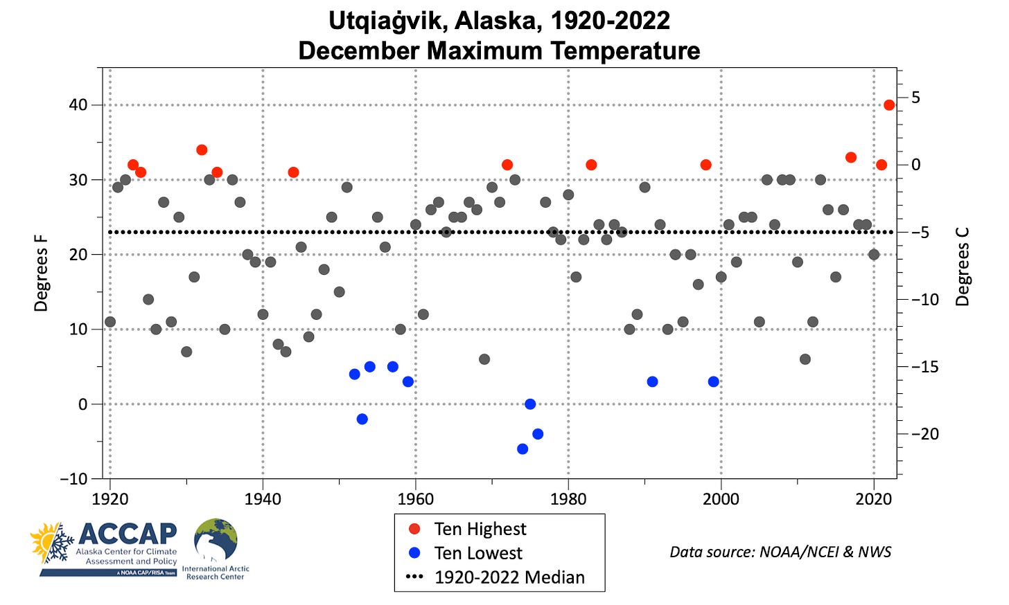
On the morning of December 5th the temperature at Utqiaġvik, Alaska, the northernmost community in Alaska (71.3°N) briefly reached 40°F (+4.4°C). This is the highest temperature on record in December at Utqiaġvik, and indeed is the highest temperature any date between October 30th and April 22nd. Overall, winter temperatures have risen dramatically in recent decades at Utqiaġvik and all of northwest Alaska, so it may surprise you to learn that the absolute highest temperatures show no trend at all. Fig. 1 plots the highest temperature each December since 1920. A couple of things stand out. First, just eyeballing the graphic you can see there’s no significant trend: the ten highest temperature are spead out over the centruy, while the ten lowest December high temperatures span the secondhalf of the 20th century. Secondly, December maximum temperatures are not evenly scattered on either side of the 103-year median (23°F, -5C). While some Decembers have had monthly high temperatures far below the median, until this month no December had seen a temperature more than 11°F (6°C) warmer than that. This “ceiling” right around freezing makes this year’s high temperature so impressive.
Why do we see this “ceiling” in high temperature in December? Three factors stand out. First, there’s no sunshine at all at Utqiaġvik in December to help boast temperatures. Second, a characteristic of the Arctic and sub-Arctic atmosphere in winter is the very frequent presence of a temperature inversion, where the temperature is lower at the ground than at elevation. This colder dense air is difficult to mix out (or replace) and usually requires a combination of wind and clouds to warm the surface air (in the spring, daytime heating from the sun can help too). And third, as temperatures reach freezing, energy starts to go into warming and (eventually) melting the snow and ice that is always present at Utqiaġvik in winter. The December 5th record temperature was the result of temperature inversion completely breaking, which allowed the very mild air that was already above the surface mix right down to the tundra surface.
A probable secondary factor in the record warmth was the presence of significant open water in Chukchi Sea south and southwest of Utqiaġvik. At this time of year, exposed sea water, which can’t be colder than about 28.5°F (-1.8°C) (otherwise it would be ice) acts as a heating pad of sorts, pumping heat into the polar atmosphere. This allowed the air near the surface to remain warmer than it would have otherwise been.
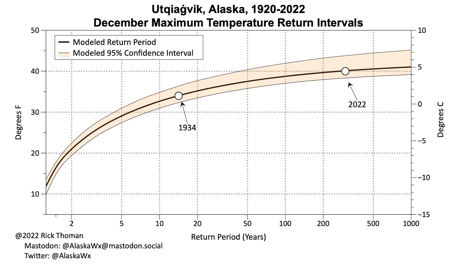
From a climate and impacts perspective, it’s of interest to ask just how rare this event was. Now right up front, this analysis is fraught with peril since the climate is changing rapidly, even if it’s not manifest yet in December high temperatures. But using the historical observations and standard statistical techniques for analyzing extreme values, we find that in the current climate, a December temperature of 40°F (+4.4°C) or higher can be expected only about once in 300 years at Utqiaġvik (Fig. 2).


