


Arctic Sea Ice: July 2024 Update
The time of year for rapid change

We’re at the time of year of when sea ice is melting rapidly in the Arctic, as accumulated early summer warmth and still substantial solar heating maximize melt rates. Additionally, in the Arctic we have now, where most of the ice is first year ice and so relatively thin, individual storms can also produce significant ice melt in short order due to warmer air and water transport and wind driven wave action.
Arctic-wide Sea Ice
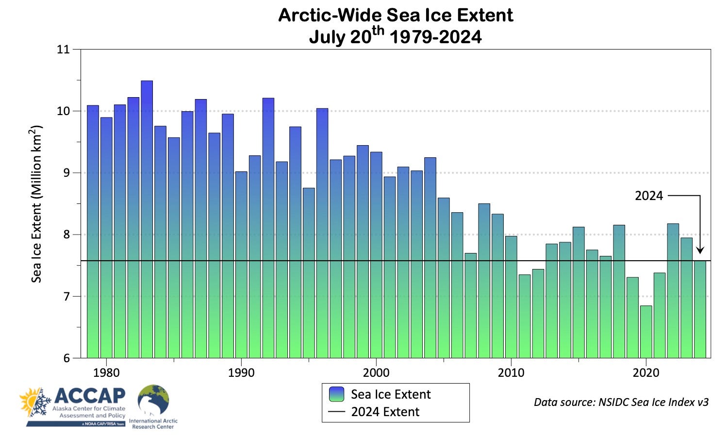
Things are changing pretty rapidly now. The National Snow and Ice data Center noted in a July 16 post that Arctic Sea ice extent the first two weeks of July decreased more than 30 percent more than usual. As seen in Fig.1, Arctic-wide sea ice extent as of July 20th was the sixth lowest since 1979 but lower than every year prior to 2011.
Regional ice extent ranks are shown in fig. 2. The Canadian Arctic Archipelago is at the second lowest extent for July 20th since 1979 and Laptev third lowest, with the Beaufort and Barents Seas not far behind. Ice extent in the Chukchi Sea remains very high (see below).

Figure 3 shows the July 20th sea ice concentration from the AMSR2 higher resolution passive microwave data. Low to moderate concentration ice in the northern Beaufort, Chukchi and Laptev seas imply a continued rapid decline in ice extent in the coming weeks.
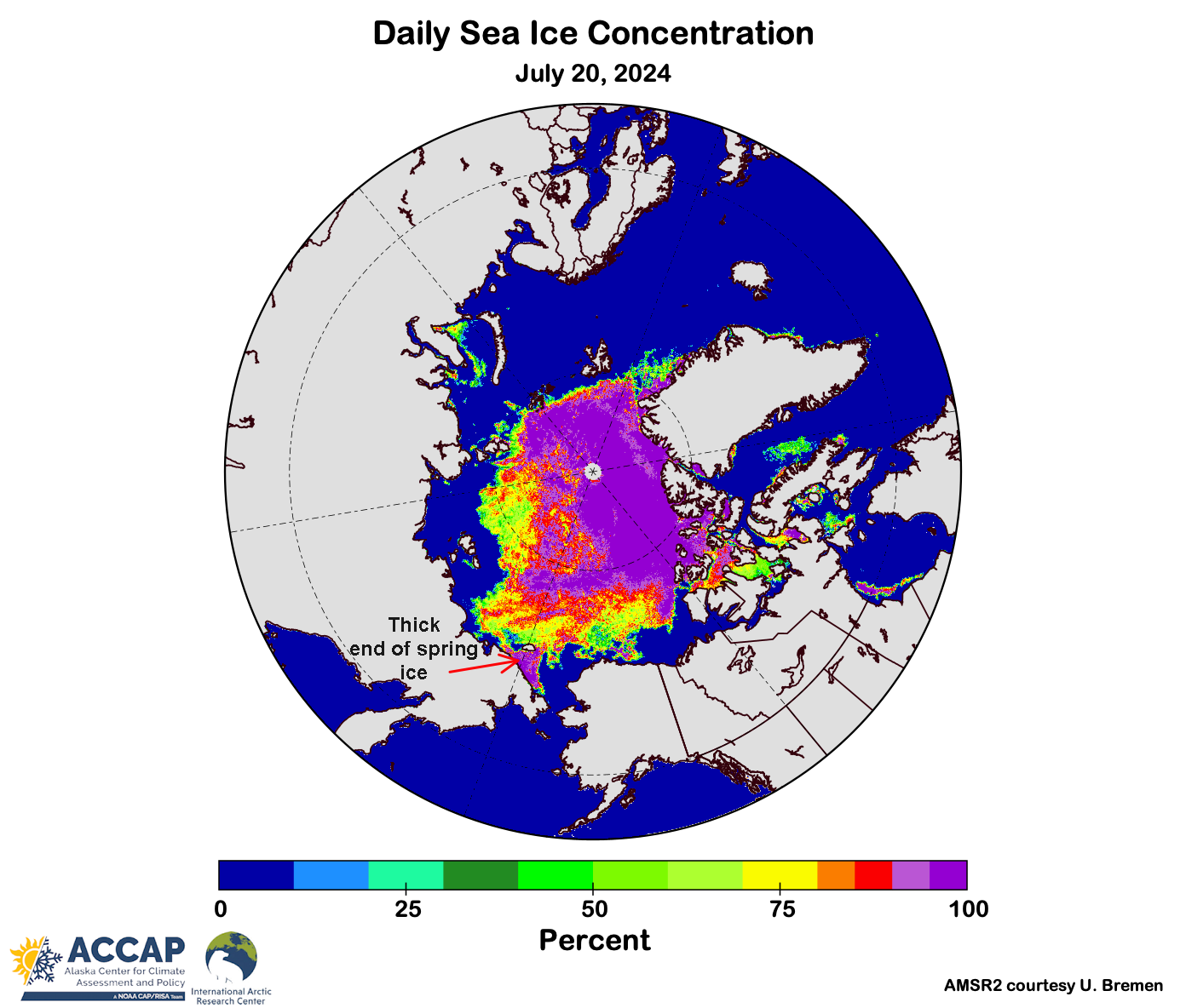
The Northwest Passage through the Canadian Arctic is not yet open but the moderate concentration ice evident in Fig. 3 in McClintock Channel and Peel Sound suggest that the southern route will likely be passable by non-ice hardened ships at least from August through most of September.
Chukchi Sea Ice
The anomalously high sea ice extent in the Chukchi Sea can be plausibly attributed to a combination of the unusually thick ice (by modern standards) at the end of the winter and persistent north winds over the western Chukchi Sea during the spring and early summer. This combination resulted in the coldest June in eastern Chukotka (Anadyr eastward) since 1988, which unsurprisingly is the last time June sea ice concentrations were as high as this year in this part of the Chukchi Sea.
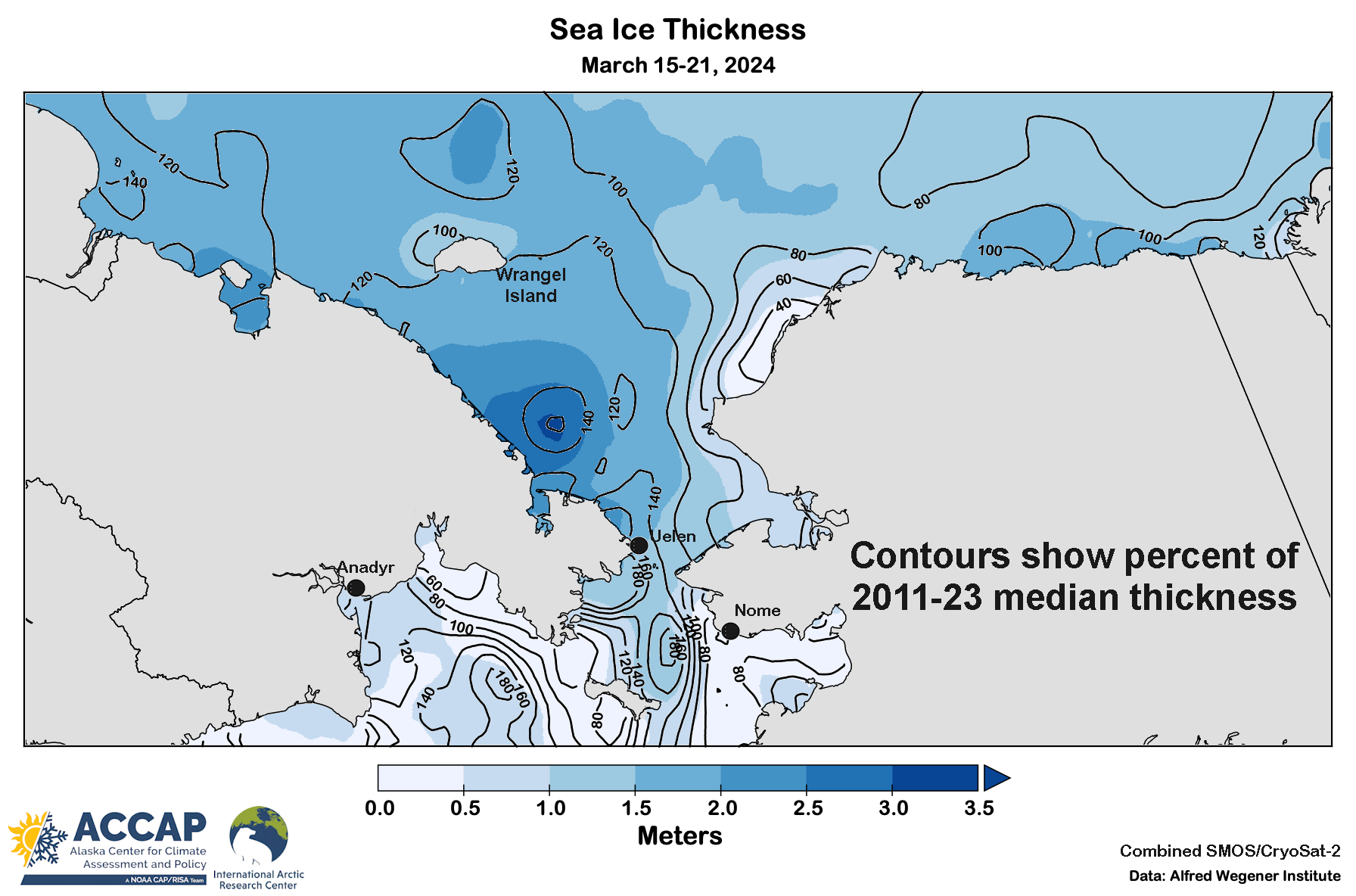
Figure 4 shows the satellite-derived sea ice thickness at Spring Equinox along with the percent of median thickness of the 2011-23 median (the period of record of this data set). Notice the area of 2 to 3.5 meter thick ice from just northwest of Uelen westward to south of Wrangel Island. Given the dominant north winds in later May and June, it’s little wonder that ice has persisted.
The weather pattern has changed through and western Chukchi Sea ice is already pushing away from the coast and melting, but this will be the last area to open up for the Northern Sea Route.