Anchorage and much of Southcentral’s bout of repeated heavy snows has ended as the weather pattern has shifted to a colder drier northerly winds aloft. This post is a wrap-up of Snowpocalypse 2022. An earlier post on this event from December 12 is here.
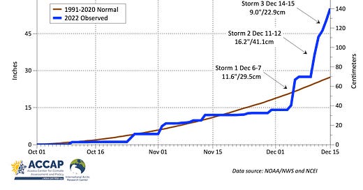
There were three major snow storms during the first half of December, plus a couple of smaller events. Fig. 1 plots the cumulative seasonal snowfall since October 1 from the daily snowfall totals as reported from the National Weather Service Office, in west Anchorage just south of Anchorage International Airport. Note that this is quite different from snow depth, which is much lower due to the normal compaction of the recent snows and melting of some of snow that fell prior to late November.

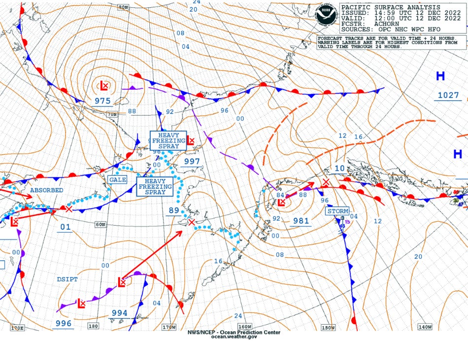
Of course, the first question is “why the repeated heavy snow”? Getting heavy snow in Anchorage urban area requires a number of factors to come together. e.g. temperatures low enough, sufficient moisture through the lower and middle atmosphere and, the most critical this time of year are wind directions aloft. Because of the orientation of the mountains (both east and west) and Cook Inlet, there is a rather narrow window of wind directions and related storm tracks that will bring heavy snow to Anchorage. Fig. 2 shows the surface weather analysis from the NWS Ocean Prediction Center for 6am AKST Monday, December 12, which was toward the end of the second storm. This storm had tracked from Kodiak Island Sunday late afternoon to its 6am center just south of Seward. This is a classic track for heavy snow in Anchorage: storms that track much farther north or west usually produce too much flow across the Chugach Mountains, which serves to “wring out” moisture and or bring in air mild enough to change snow to rain at low elevations. Too far south and and east and the precipitation does not reach the Anchorage area. In Snowpocalypse 2022, three storms in 11 days moved along the favored track.

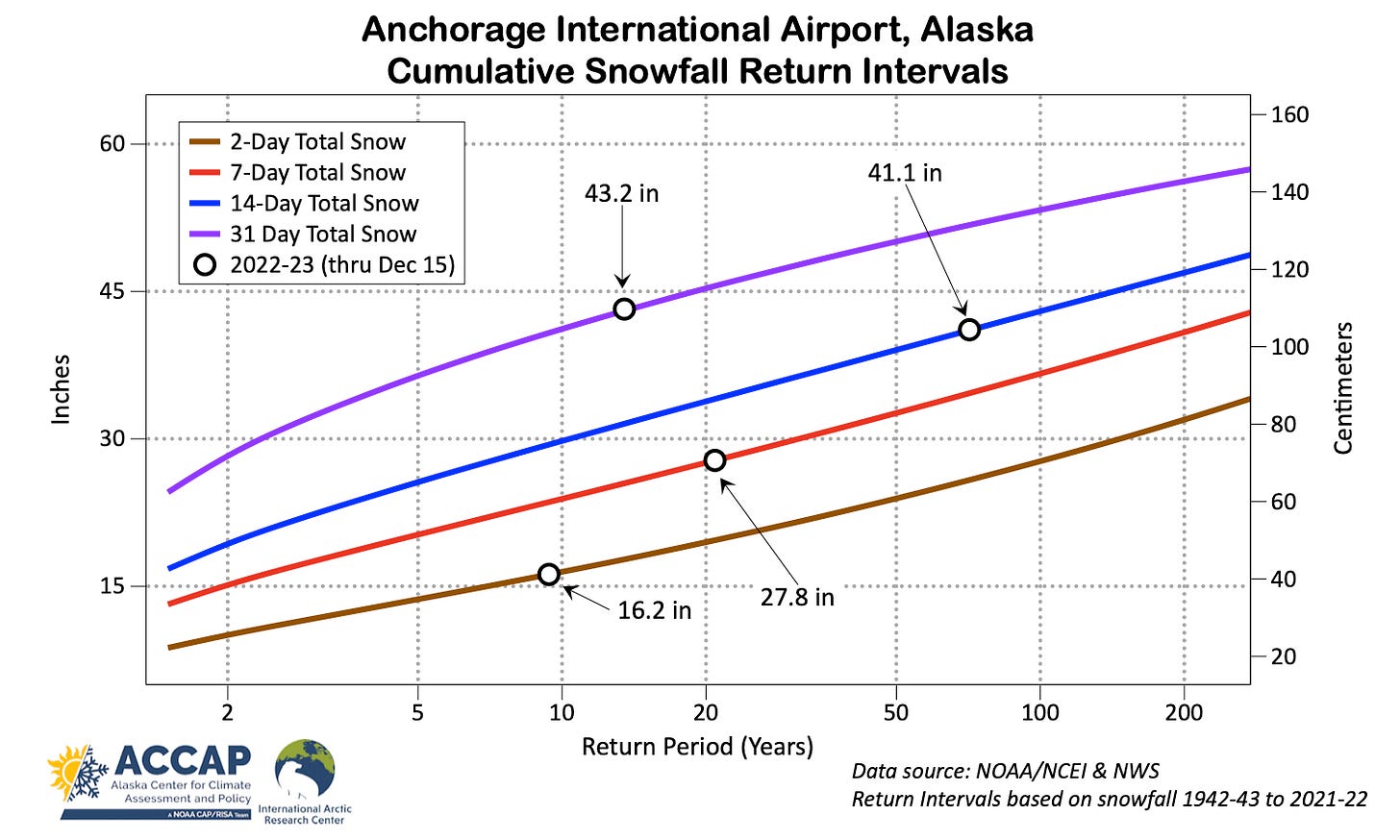
Figure 3 shows the updated snowfall return interval plot with the 2022-23 values as of December 15. The 14-day snowfall of 41.1 inches (104.4 cm) is now way up into the rare category, with an average return interval of 71 years, or, about a 1.5 percent chance of happening in any given winter. However, Snowpocalypse 2022 did not set a record for total snowfall for any period. The early February 1996 snows were slightly higher at the Airport: 44.6 inches (113.3 cm) in 11 days and 45.1 inches (114.6 cm) in 14 days.

From the climate perspective, by far the most extreme feature of this event was the amount of water (in the form of snow) that came done. The automated observation at Anchorage Airport reported 3.75 inches (95.3 mm) precipitation between December 5 to 15th, and at the NWS Office, using a different kind of precipitation gauge (and 2 miles/3km apart), the 11 day total was 3.94 inches (100.1 mm). This is completely “off the charts”: this by far the highest cold season precipitation total on record. In fact, December 2022 already has the highest precipitation total for any month between November and June. We’ll go into more detail on this facet of this event in a separate post, but the climate change aspect of this event is here, rather than the snowfall totals.


A bit more detail from when I had my first official lead forecaster job in ANC (1977) ... the 'classic' setup for prolonged (12-24 hrs+) snow events in ANC generally required the GOM storm to occlude out near Middleton Island with the decaying center then drifting towards & then into Prince William Sound where i would spin itself out. ANC surface winds were almost always northwesterly.