
Alaska Snowfall Trends
Another Case of Changing Seasonality

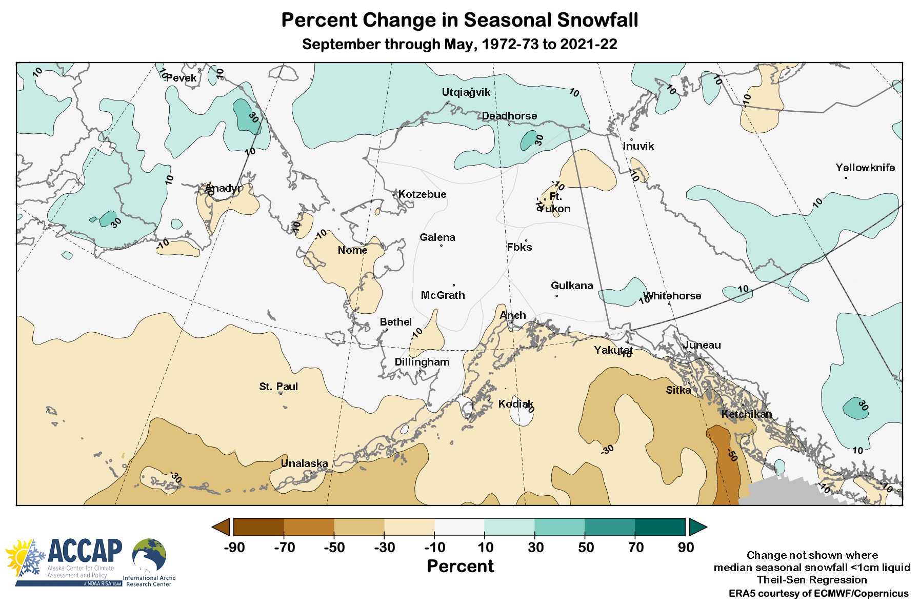
Annual snowfall trends over the past 50 years for most of Alaska and vicinity are weak, but there are clear geographic patterns, as since in Fig 1. From northern Chukotka, across the Alaska North Slope into the northwest Northwest Territories; that is, areas near the Chukchi and Beaufort Seas, snowfall is trending higher. In contrast, in the central and southern Bering Sea and Gulf of Alaska and adjacent coastal areas. there is a trend toward less snow. In between, most areas in Alaska and the Yukon show little change. However, that’s not the whole story.
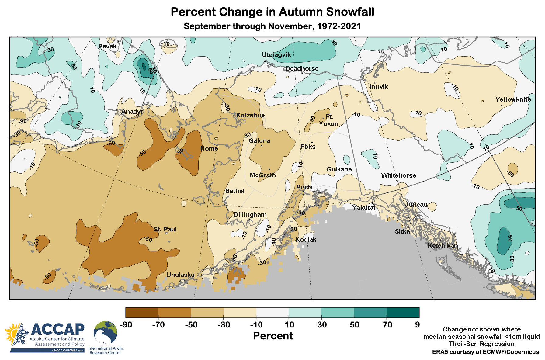
In fact, there are dramatic changes in the seasonality of snowfall happening that have important societal and environmental impacts. For many area away from the Bering Sea and Pacific Oceans, autumn (especially October and November) was historically snowy and contributed a significant portion of the annual total snowfall. However, that is changing, especially across western and southern Alaska. In most areas this is due to more of the autumn precipitation is nowadays falling as rain rather than snow.
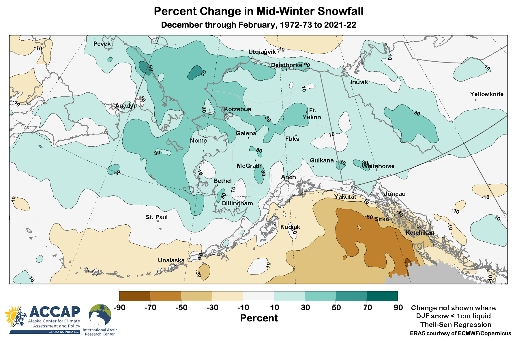
The situation is completely different in mid-winter, December through February. Almost everywhere from Chukotka across mainland Alaska and into the Northwest Territories is trending toward more snow. The main exceptions are along the Gulf of Alaska coast (especially the outer coast of Southeast Alaska) and the Aleutian Islands, where again more precipitation is falling as rain these days.
Both of these observed trends are exactly what we expect in a warming world. As ocean temperatures rise, there is more water vapor evaporating into the atmosphere. In the fall, the warm oceans are keeping low elevation temperatures high enough for longer into the season to reduce snowfall. In winter, temperatures are still low enough that the extra precipitation is falling as snow, even though at least in some areas (like Southcentral and Interior Alaska), there is more rain-in-winter than there used to be. But that’s a story for another post.