
Arctic Sea Ice: June 2024 Status
Arctic Sea Ice: June 2024 Status
Overall typical for recent years, but with regional extremes

Sea ice in the Arctic is is following the normal seasonal decline. Mid-June ice extent this year is very similar to the past two years though lower than 2016-2021, but still well below the 1981-2010 10-90th percentile window. Overall, as of June 17, 2024, sea ice extent was the 10th lowest since 1979. However, after accounting for trend, with three months to go in the Arctic melt season this is not an especially useful predictor of the September minimum. That will be determined by the weather and ocean factors in the coming months.
Sea ice concentration and thickness
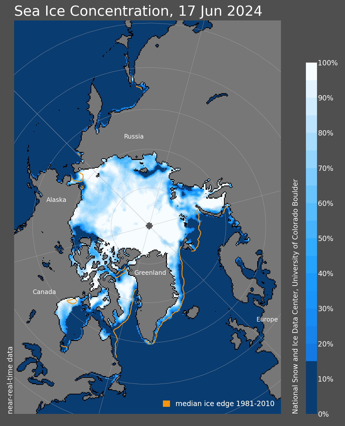
Figure 2 shows the Arctic sea ice concentration as of June 17, along with the 1981-2010 median ice edge. Concentrations show a typical early summer pattern, with moderate concentrations increasingly widespread north of the of the ice edge, especially south of 80°N.
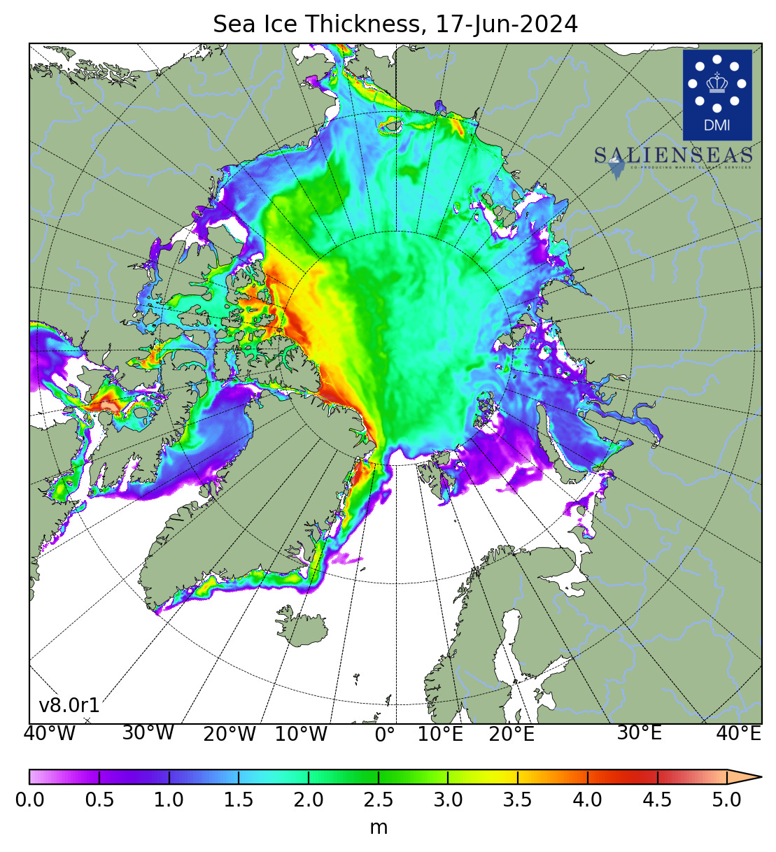
Sea ice thickness can be tricky in the summer, but the modeled thickness from the Danish Meteorological Institute can still be useful over the high Arctic. This shows the 3 plus meter ice remains confined to the northern Canadian Arctic Islands and north coast of Greenland, with some 2 to 3 meter ice in the Beaufort Sea north of 75°N. The lack of really thick ice north of the Russian coast is notable but is in line with recent years and the loss of old (4 year or more) ice from the Arctic.
Regional sea ice
Figure 4 shows the rank of the June 17 ice extent in the various basins around the Arctic. There are a couple of standouts here: Hudson Bay has by far the lowest ice extent for this point in the season, 17 percent lower than the previous June 17th minimum ice extent that occurred in 2010. Reminiscent of last summer, the Canadian Arctic Archipelago and Beaufort Sea have very low extent for this point in the season. On the other hand, sea ice extent in Chukchi Sea is the highest since 2000 and 10th highest since 1979.
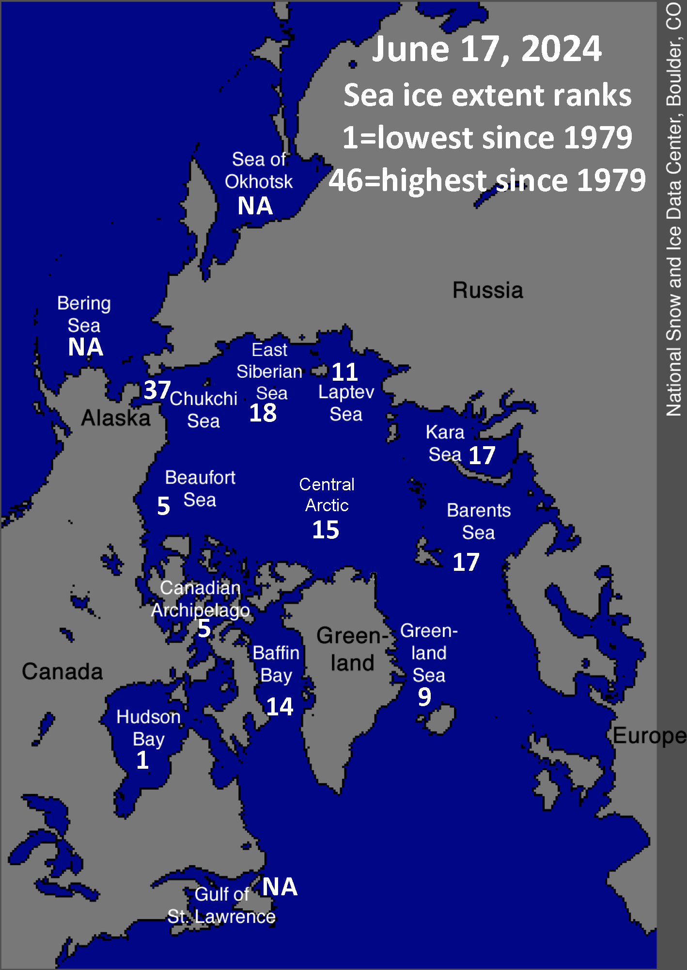
The Bering Sea, Sea of Okhotsk and Gulf of St. Lawrence are shown as “NA”, as any remaining ice is now in the “noise level” of the resolution of the near-real time passive microwave derived product, e.g. the spurious near-shore ice indicated in Fig 2. in Bristol Bay, southwest Alaska and the Gulf of St. Lawrence, between the Newfoundland and Quebec coasts.
Really interesting. What are the principle drivers for that Chugach anomaly,?