

April 2024 Snowpack Analysis
April 2024 Snowpack Analysis
Dramatic differences across northwest North America

Spring is underway across central and eastern Alaska. Days are lengthening rapidly as of April 17th, north of 61°N, it’s no longer getting completely dark at night), birch sap is flowing and snow is melting. And with Spring comes river ice break-up and the prospect of ice jam and/or snowmelt flooding.
Snowpack
Snowpack snow water equivalent (SWE, the amount of water that the snowpack would melt down to), according to ERA5 reanalysis, as of April 11, 2024 was near to above the 1991-2020 median for the date over most of mainland Alaska. The snow over lower Kuskokwim River valley was very high the area on the Alaska Peninsula with greater than 200 percent median is mostly a reflection of median low elevation snow cover at this point in the season is close but not quite at zero).
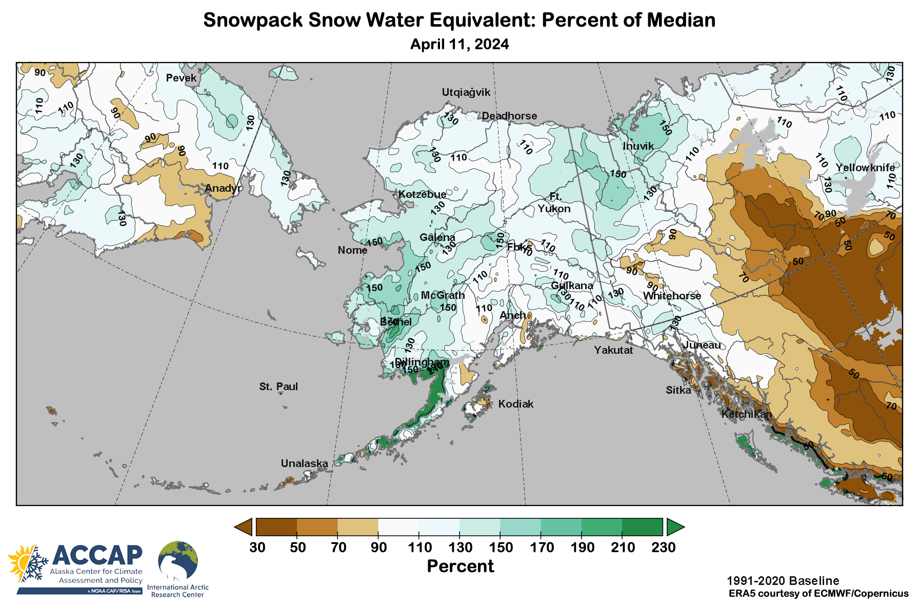
While the northern Yukon Territory and far northwest Northwest Territories also had above normal snowpack, it was a different story across central and southern Southeast Alaska, British Columbia and the western Northwest Territories, where snowpack was way below normal, and some areas in northern Alberta area show up in the ERA5 analysis as snow free. Figure 2 shows the National Ice Center’s Interactive Multisensor Snow and Ice Mapping System snow and ice cover analysis for April 11, 2024, showing the area without snow cover extending into northeast British Columbia.
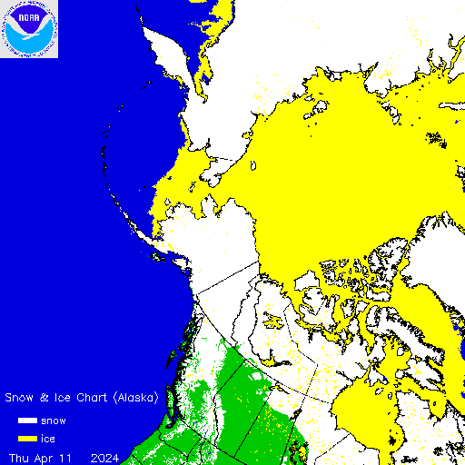
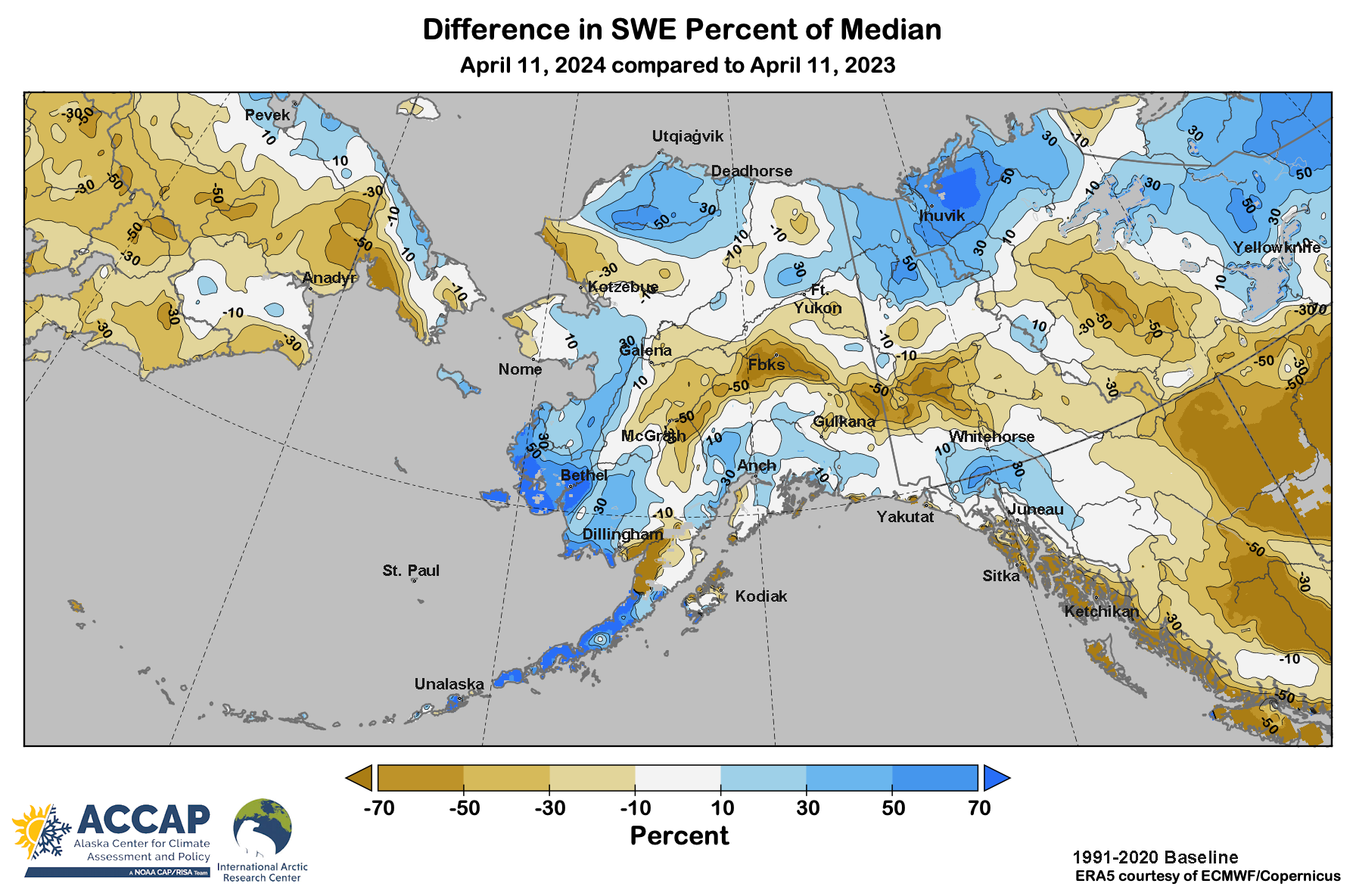
Figure 3 shows a comparison of this year’s snowpack departure from median compared to the same date in 2023. The Tanana valley stands out, with much lower snow water equivalent than last year (or 2022). and this extends eastward into central Yukon Territory. In contrast, snowpack was much higher than last year on the western North Slope, parts of Southcentral Alaska and especially in southwest Alaska.
Community Flood Potential
The Alaska community river breakup flood potential assessment from National Weather Service Alaska-Pacific River Forecast Center as of April 12 (Fig. 4) reflects current snow and ice conditions as well as historic risk reflecting the local topography and river characteristics. For example, Buckland (northwest Alaska ) is shown with moderate flood potential because river break-up flooding is not unusual there: the Buckland River makes a 90° turn to east just downriver of the village, and sharp bends in rivers are favored places for ice jams to form.
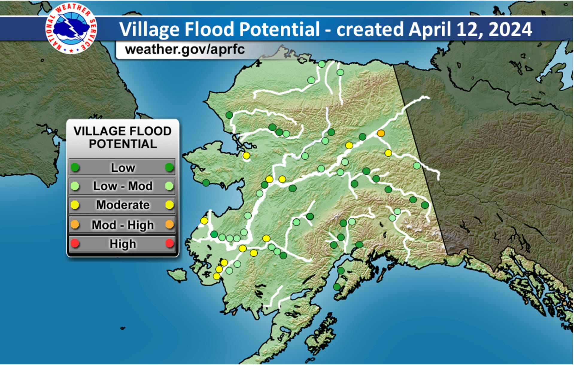
In addition to river flooding, with lots of water in the snowpack, snowmelt flooding will be a threat depending on late April and early May temperatures in the lower Kuskokwim delta region and possibly the greater Anchorage area as well.
Note: I’m moving house this month so posting is a bit delayed.
Technical details:
Temperature and precipitation analysis spatial maps and time series from ERA5 reanalysis data from ECMWF/Copernicus, available here.
U.S. National Ice Center IMS analyzes are available here.